Cleanly broken by a 900 kg, nuclear-powered Martian robot
#Mars May 15, 2025 - Curiosity Sol 4541
Credits: NASA/JPL-Caltech/MSSS/fredk


Cleanly broken by a 900 kg, nuclear-powered Martian robot
#Mars May 15, 2025 - Curiosity Sol 4541
Credits: NASA/JPL-Caltech/MSSS/fredk
Ranger Sarah has found a mushroom rock. The sandstone and sedimentary rock are held together by calcium carbonate, which acts as a natural cement.
— at Mushroom Rock State Park.

Ranger Sarah hikes through Mushroom Rock State Park. The mushroom rocks are natural Dakota rocks, which are the remains of beach sands and sediments of the Cretaceous Period.
— at Mushroom Rock State Park.

Ranger Sarah views her first rock. Mushroom Rock State Park is tucked into the Smoky Hills region in the north-central part of Kansas.
— at Mushroom Rock State Park.

Ranger Sarah is at Mushroom Rock State Park in Kansas. This massive state park covers 5 acres.
— at Mushroom Rock State Park.

Captured 4 hours ago by Perseverance after further driving down the lower slopes of the rim of Jezero Crater
#Mars May 19, 2025 - Sol 1509
Credit: NASA/JPL-Caltech

Generative art/design inspiration: https://en.m.wikipedia.org/wiki/Liesegang_rings_(geology)
(via @kate)
 — from the linked Wikipedia page. Photo license: CC0")
New entry of AI-generated #comics and #jokes added to our #website:
comics.lucentinian.com/7884
#NewsLaughs #VisitNow #LaughWithAI #FunnyNews #Comedy

I’m curious about a thing that’s appeared at the beach that I think is a rock. I feel a rock scientist will know why it has this pattern. It’s rock heavy in the hand. But it’s clay adjacent.
Location: east coast Australia just north of Wollongong.
Update: edited to save Osa’s notifications, but also to thank everyone who’s filling my timeline with amazing new knowledge.
One more update, as geologists have entered the thread! and the consensus is indeed (drum roll) liesegang banding in the concretion. Even writing these words is astonishing to me. What a world.
Thank you #geology.


I always thought these were the best photos of the St Helens eruption that occurred 45 years ago today. Can you imagine being there and seeing that!!!
(Photos by John Christiansen from Mt. Adams when Mt. St. Helens erupted on May 18, 1980.)

Eyewitness to History: The 1980 Eruption of Mount St. Helens
Author note: This article contains the memory of my great-grandfather Charles Mulvey who was working on the Hanford Site near Richland, Washington when Mount St. Helens erupted. A few days after the eruption, he wrote this short essay about his experience. It was recently found by my aunt Diane Izzo when she was looking through family effects. The text provided below has no alterations from the original.
May 20, 1980
Well, the Spirit Mountain did as the Indians have been telling us it would do. It spoke real loud and was heard as far as Spokane anyway. It seems Mount St. Helens still has a lot of life left.
So I guess I’ll make an attempt to give some of the sights, impressions, and feelings which I observed and felt during and after the eruption which occurred this past Sunday, May 18, 1980.
Ingalls Weather thanks the support it gets from donors. Please consider making a small donation at this link to help me pay for the website and access to premium weather data.
Mount St. Helens has been gradually changing from its former inactive status to active with mostly relatively mild eruptions and steam, ash emissions. The officials concerned and those persons observing the volcano have repeatedly given warning of the serious potential of a major eruption.
Sunday morning at approximately 0830 a.m. Mount St. Helens erupted with an explosion which blew the top 1300 feet off of the mountain and formed a horseshoe shaped crater. A huge cloud of ash and debris was reportedly blown to an altitude of 60,000 feet.
Type your email…
Subscribe
I was at work and doing my job assignment this day. I heard the blast and thought that that was no sonic boom but possibly a large dynamite explosion. The time is not definite but seemed to be just before 0900 a.m.
There was earth movement reportedly felt by others, however I felt no movement of which I was aware.
I continued with my work routines and sometime near 1000 I noticed the western sky getting dark and appeared smoky as if the fruit growers in the Yakima Valley were fogging to save the fruit crop. Of course, the day had started out clear, sunny and warm. Fruit fogging was out of the question.
The sky continued to darken rapidly and a radio transmission was heard telling all listeners that Mount St. Helens had erupted. More information would be transmitted as it was received.
By 1030 the sky was rapidly being covered with a huge, flat bottomed cloud which eventually covered all visible horizons completely blacking out the sun.
My job assignment was partly the responsibility of watching a pumping operation and the recording of operational data. At the 1100 time for a check of the pump and data the cloud had covered the sun and the northern and southern horizons and all except the east portions.
The westward facing field lamps were being activated. These field lamps light up with detection by a photo cell of approaching dark conditions.
By the time I had completed my periodic check of the pump operation and returned to the building, full darkness had occurred and the fallout of volcanic ash was underway. The darkness was equal to that of a moonless, starless, possibly cloudy stormy night.
During the next two hours the ash fall continued, with an appearance of a dry rain, if such were possible. The particles of ash ranged from a fine powder to a coarse sand. The coarse, sandy material was heavy, and the find powdery material is extremely light, almost a talcum powder.
At the 1300 time check of the pump, the ground and all horizontal exposed surfaces were covered with ash to a depth range from one-eighth to one-quarter inch deep. The ash was evenly distributed and created considerable dust when vehicles were driven.
Light conditions at 1300 required use of a flashlight to observe numbers and dials. The pump incidentally was stopped at 1315 hours due to the hazardous conditions.
The ash fall continued heavy until approximately 1430 when the sky lightened again to daylight. A light dust ash fall continued. A dusty haze filled the air and it was necessary to don dust filters or face masks for working outside. Some samples of ash were taken for souvenirs at this time.
The light ash fall continued for the remainder of the day and possibly throughout the night. A souvenir ash sample of this light ash fall was taken the following morning from a surface which was clean at the time the initial ash fall samples were taken.
The volcanic ash fall covered a large area of eastern Washington. Roads and highways were closed due to extremely dusty conditions which made driving very difficult. People were warned to stay off the roads and to stay indoors.
The severity of the ash fall was relevant to the depth of the ground cover. This ranged from a trace to several inches. Towns and cities within the fallout area have encountered difficulty with removal of the volcanic ash.
The bus which picked us up at work and transported us home was a casualty of the dusty conditions. Dust clogged the filters and was pulled into the motor which failed due to the abrasive ash. Only the front part of the bus was visible as it approached. It was lost in dust back from the front wheels.
A light ash fall continued the following day with extremely dusty air conditions. Only essential work was being done, and usually only necessary stores (grocery, etc.) were open.
High winds have swept the area since the eruption which continually creates more dust conditions.
The featured image is of the eruption column from Mount St. Helens on May 18, 1980. (USFS)

45 years ago today Lawetlat'la (Mt. St. Helens) erupted. This is probably my most recent photo (2022) of this local volcano from near Panorama Point on another volcano Tahoma (Mt. Rainier).
1/3

Curiosity looks back at Devil's Gate, Wilkerson Butte, and beyond, from her workplace by the boxwork structure
#Mars May 15, 2025 - Sol 4541
Credits: NASA/JPL-Caltech/MSSS/fredk

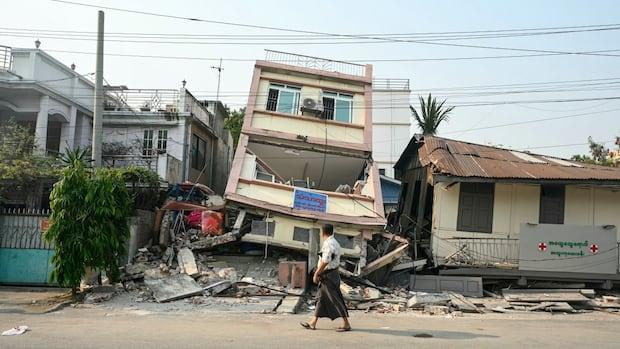
Scientists gobsmacked by never-seen footage of earth rupturing during Myanmar quake
The video was captured by a surveillance camera on March 28 when a violent earthquake struck the southeast Asian country of Myanmar — causing widespread damage as far away as Bangkok in neighbouring Thailand, and killing some 3,700 people, according to Myanmar's ruling military ...
#earthquake #science #geology #Myanmar #News #World
https://www.cbc.ca/news/world/myanmar-earthquake-rupture-video-1.7536653?cmp=rss
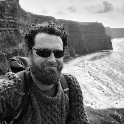
X marks the spot - a battered Septarian nodule.
County Clare, Ireland.
Cormacscoast.com walking tours
#wildatlanticway #walkingtours #discoverireland #keepdiscovering #septariannodule ##geology ##burrenandcliffsofmohergeopark #atlanticgeoparks #Ireland


Mt St Helens is in southern Washington State, but visible on any clear day from Portland, Oregon as part of the skyline to the north. Though today was cloudy, a recent photo I posted had a view of Mt St Helens from my home in NE Portland. It shows now-flat-topped Mt St Helens 50 miles/80 km in the background behind a KLM 787-10 Dreamliner in the foreground 2 miles/3 km away as it was landing at PDX. https://avgeek.social/@ikluft/114389463012838604 #volcano #geology #aviation #avgeek #PNW
 around its right flank twice as far away.
photo by Ian Kluft
April 23, 2025
Portland, Oregon")
"Mount St. Helens: Eyewitness to History, a KGW+ Special" by KGW News (NBC Portland) - KGW's news special from Friday for the 45th anniversary of the May 18, 1980 Mt St Helens eruption, including their archived footage and reporting. It was KGW's news helicopter that first spotted the open crater at the peak of Mt St Helens in March 1980, which they checked because frequent quakes indicated the volcano was waking up. https://www.youtube.com/watch?v=HOeSY1yi1Q4 #MSH45 #volcano #geology #PNW #history #TDIH
45 years ago, May 18, 1980: the big eruption of Mt St Helens. It started with the biggest landslide in recorded history as the northeast side of the mountain slid away. That uncorked the gas-pressurized magma inside the mountain that exploded without the weight holding it down. An 8 hour eruption killed 57, flattened forests and sent mudflows downstream. Volcanologists learned a lot from it. USGS article about the eruption: https://www.usgs.gov/volcanoes/mount-st.-helens/science/1980-cataclysmic-eruption #MSH45 #volcano #geology #PNW #history #TDIH